


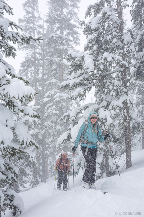
After the 16″ dump over the weekend, it has just kept on snowing here in the San Juans, for a total of 30″ of fresh snow by Wednesday! Of course I’ve been out every day shredding every inch of the powder. Spring powder fever has a similar intensity as early season powder fever, except that this time of year the stoke comes from knowing that it’s all going to melt soon.

We lapped this perfect, long heel-side snow wave several times; I almost felt like I was in Costa Rica.
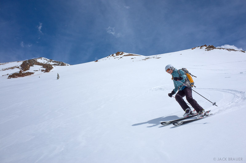
Is it April? Or February? I can’t tell the difference.
Here’s a few photos from three ski days this last week here in the San Juan Mountains, Colorado.
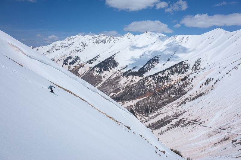
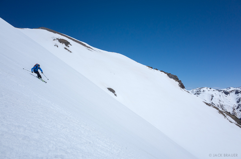
The spring skiing has been great lately, with smooth corn snow and some of the higher pass roads getting plowed out enabling easy access into the high country.
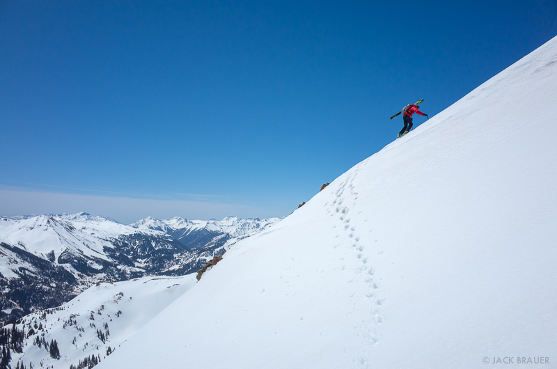
Matt and I climbed and skied/snowboarded a huge face that I’ve been eyeing for years.
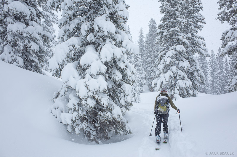
Then a potent storm rolled into the mountains this weekend, dumping over 16 inches of fluffy powder. Woohoo!
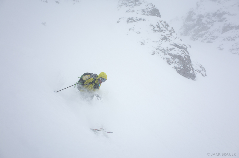
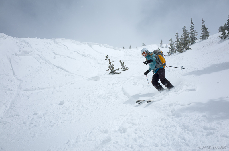
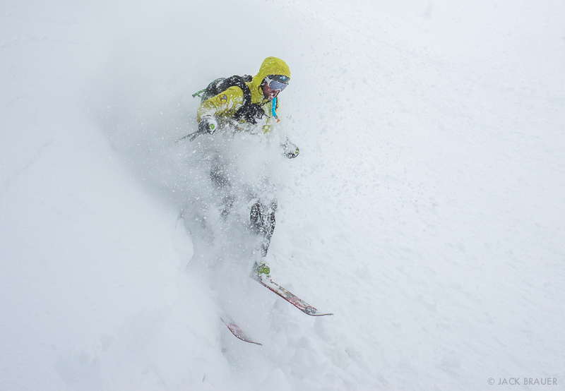
Possibly the deepest snow of the year so far… It felt less like skiing and more like swimming through clouds. Too many face shots to even see where we were going!
This winter refresh should provide another week or two of excellent skiing and splitboarding… if my legs can keep up!

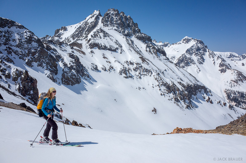
On Friday, Claudia and I got back out into the mountains to enjoy some more turns. Monday’s foot of fresh snow had baked down to about 3-4 inches of old powder corn snow (For those who don’t backcountry ski, “corn” snow is snow that goes through multiple melt/freeze cycles, resulting in a firm but smooth snow surface that softens up nicely by around noon on a sunny spring day. In my opinion, it’s the next best thing to fresh powder!)

I took Claudia up to one of the taller peaks around. It was Claudia’s first time skiing corn snow, and she rocked it!
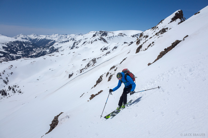
We skied/snowboarded from the summit down a beautiful long untracked line, then skinned back up to the high ridge and scored a nice long bonus descent down the front side. What a day!

As we drove home from our recent desert road trip, the rain we passed through in Utah had turned into snow when we reached the San Juans in Colorado. Despite my desire to rest after our big trip, I knew I couldn’t pass up a beautiful spring powder day!

A fresh foot of powder blanketed the San Juans on Monday. What a great welcome home to the mountains – just like last time we returned from the desert!

The snowpack was sturdy after the previous warm days melted the various snow layers, followed by cold nights that froze it solid again. The new snow came in wet, bonded well to the surface, and then became blower powder on top. Perfect conditions for riding some bigger, longer lines up in the high peaks!

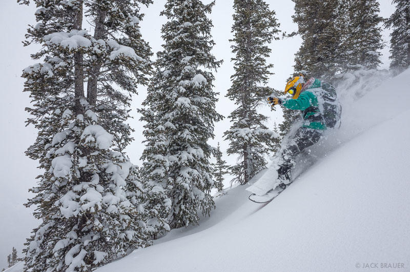
Skier: Dan Chehayl.
We skied/snowboarded through this big gully I’ve had my eye on for years, followed by a second lap up high again.


The last stop on our two-week road trip through southern Utah was the famous Bryce Canyon National Park, which Claudia just had to see since we were so close already in Escalante. The shot above was taken right before we randomly ran into my photographer friend Rich Voninski. Nice to see you, Rich!

Ominous dark clouds contrast with the brilliant orange spires of Bryce Canyon.
Despite the threatening storm clouds, we day-hiked the Peekaboo and Queens Garden loop trails and were fortunate to not get rained on! The dark clouds actually provided a wonderful atmosphere against the bright orange hoodoos all along the trail.

Ominous stormy clouds over Bryce Canyon National Park – April.

Sunset over Panguitch and the Sevier River valley as seen from Red Canyon.
After hiking the fantastic trails in Bryce, we needed to escape the crowds there since we were more adjusted to solitude after two weeks of camping on our own in the wilds. So we headed over to nearby Red Canyon and found a nice secluded camp spot for the evening. A quick scramble above our camp provided a broad vista from which to enjoy a windy sunset.

Ominous clouds signal the approach of a spring storm – April.
That night it poured rain for the first time on our trip, and with the continuing stormy weather in the morning we decided it was time to end our desert journeys and head home to the mountains.

Sunset reflection in a small waterhole at our slickrock campsite along the Boulder Mail Trail.

Sunrise illuminates a sea of slickrock along the Boulder Mail Trail between the towns of Escalante and Boulder.
The morning after returning from our previous Escalante backpack, we embarked on another even more adventurous trek – this time into the slickrock country just east of the town of Escalante. For years I’ve driven the spectacular stretch of highway between Boulder and Escalante and always wondered what it was like up amongst all that slickrock. During this trek we would find out! Continue reading “Death Hollow Loop”

The Henry Mountains rise above the slickrock desert between Boulder and Escalante.
The Escalante region is one of my favorite areas in the southern Utah desert. Though perhaps less impressive at first glance than other Utah destinations, a little bit of hiking reveals countless deep canyons and slots. The variety of canyon country around Escalante is staggering.

Camping under a huge alcove near the Escalante River.
I wanted to show Claudia a few of the classic canyons off the Hole in the Rock Road, so we backpacked down in there for two nights, establishing a base camp from which we could explore several narrow canyons on day hikes.

Hiking through a deep canyon tributary of the Escalante River.
One day we visited one of the more popular canyons around here, Neon Canyon, but unfortunately while we were there it was mobbed by a large group of backpackers which diminished the mystical experience of the place a bit. I wasn’t able to produce any better photos than from my previous visits to Neon, so I haven’t posted any here. I think it’s a sign I’m getting older when I start to have more and more stories about how things “used to be”! For example during my first visit here back in the 90’s before Escalante became a national monument, my friends and I were the only people around for many miles and it felt like a true desert wilderness. We even camped right underneath the Golden Cathedral, something that would probably be considered quite disrespectful today. Maybe it was then too…

A little whirlpool generates bubbles in a small canyon creek.
Despite my griping, there are still many empty canyons to explore and plenty of solitude to be found out there!
Light painting amongst the spires of Cathedral Valley.
Our recent dirt-road route around the San Rafael Swell in Utah took us briefly through the Cathedral Valley on the far north end of Capitol Reef National Park. We spent an evening in Lower Cathedral Valley, having fun experimenting with some large-scale light painting (thank you Claudia!) and catching the sunrise light on the Temple of the Sun, a pointy spire that pokes improbably out of the surrounding flat valley.

Sunrise light in Lower Cathedral Valley.

A spring snowstorm passes over the Little Grand Canyon, through which the San Rafael River flows.
Although this is my so-called “Mountain Photographer” blog, the next several posts will be full of desert and canyon photos instead! During the first two weeks of April, we were out on a road trip through southern Utah visiting some old favorite spots as well as some new territory for us. We spent the first week exploring the often-overlooked San Rafael Swell region.
Anybody who has driven across I-70 through Utah is probably familiar with the San Rafael Reef, where the highway boldly cuts through the vertical red walls of jagged, tilted sandstone – one of the most dramatic stretches of interstate highway in the country. That impressive highway cut, along with Goblin Valley and the popular Little Wildhorse Canyon, are the most well known parts of the Swell; but as we discovered on this trip, they are just the tip of the iceberg [or sandstone, I should say]. The San Rafael Swell is a huge area with canyon scenery on par with the best that Utah has to offer. Continue reading “Exploring the San Rafael Swell”